Featuring vibrant colors, a streamlined interface, and combined coastal/inland content with a popular Navionics style color palette, Garmin Navionics+ cartography makes it easy to plot courses with the world’s No. 1 name in marine mapping.
microSD/SD format
Navigate with the best offshore and inland lake coverage for a Garmin chartplotter
Customize the view with various chart layers and overlay combinations
With the included one-year subscription, access daily updates via the ActiveCaptain® smart-device app
Auto Guidance+ technology lets users navigate with suggested dock-to-dock routings
Select up to 10 color-shaded target depth ranges to scope out the best fishing spots
Save money by renewing the subscription — and continue accessing daily updates plus new content downloads
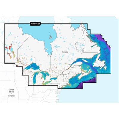
Detailed coverage of coastal and inland waterways of Eastern Canada (except YT and NU). Coverage includes all the Great Lakes, the St Lawrence River, The Maritime Provinces and the Grand Banks.