Garmin Navionics Vision+ premium cartography offers everything included in Garmin Navionics+ with additional chart features such as high-resolution relief shading, satellite imagery, 3D views and more.
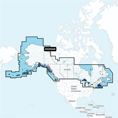
Featuring vibrant colors, a streamlined interface and combined coastal/inland content with a popular Navionics style color palette, Garmin Navionics+ cartography makes it easy to plot your course with the world’s No. 1 name in marine mapping.
Features:
Navionics advanced dock-to-dock route guidance technology uses your boat settings, along with chart data and frequently traveled routes, to calculate a suggested path to follow.
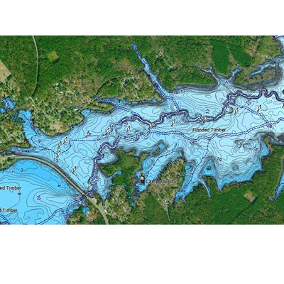
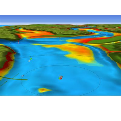
Improved fishing and navigation, SonarChart™ HD bathymetry maps display up to 1’ (0.5 meters) contours, providing a more detailed depiction of the bottom structure
Fishing range advanced feature lets you highlight a user-defined target depth range.
SonarChart Live mapping feature allows boaters to create new personal 1’ HD bathymetry maps that display in real time on the screens of their compatible plotters while navigating
Compatibility:
Echomap UHD (7/9)
Echomap Ultra (10/12)
GPSmap 10X2/12X2)
GPSmap 12X2 Touch
GPSmap 7X2, 9X2, 12X2 Plus
GPSmap 7X3/9X3/12X3
GPSmap 8400/8600
GPSmap 8700 Black Box